LESSON 1
How Do Scientists Track Whales, Sharks, and Turtles?
Introduction:
Following the Movement of the Sea
Whales migrate thousands of kilometres. Sharks dive to incredible depths. Sea turtles return to the same beach where they were born. But how do we know any of this?
Thanks to advances in marine technology, scientists can now track ocean animals as they swim, dive, feed, and migrate—unlocking secrets that were once impossible to know.
In this lesson, we’ll explore how researchers track the ocean’s biggest travellers, what the data reveals, and how it helps protect marine life.
1. Satellite Tags: Eyes in the Sky
Satellite tags are one of the most powerful tools scientists use to follow animals across vast distances.
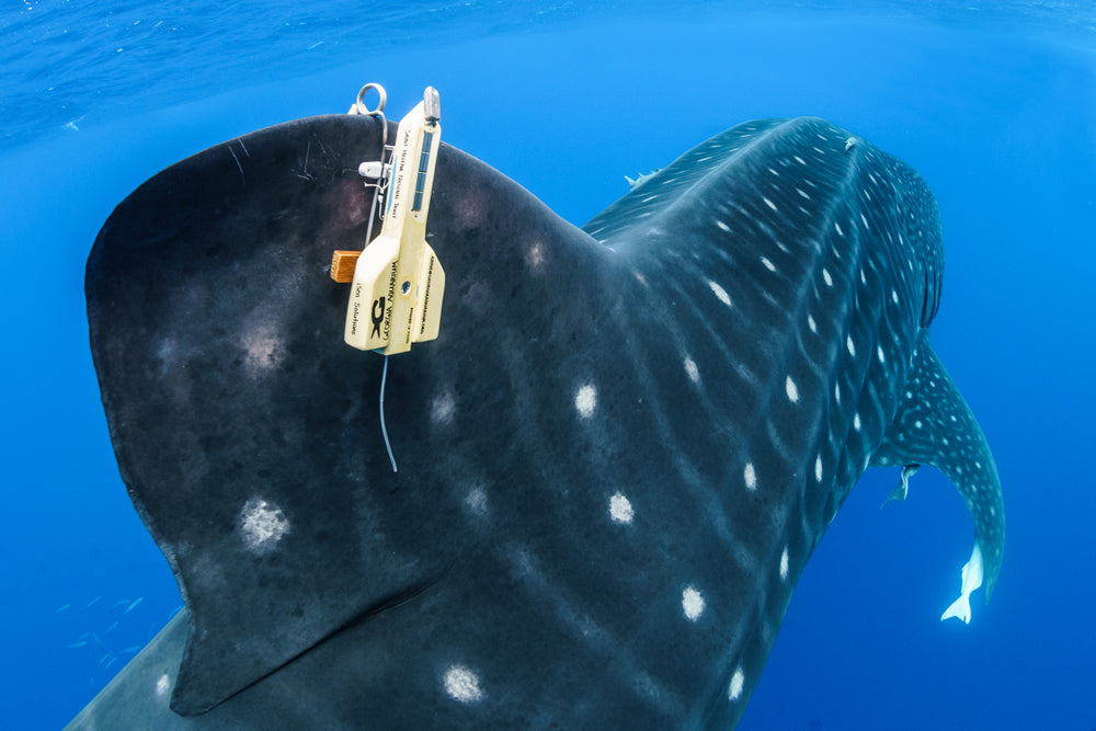
How it works:
- A small tag is safely attached to an animal’s fin, shell, or dorsal surface.
- Each time the animal surfaces, the tag sends a signal to orbiting satellites, revealing its location.
- This data is mapped to show migration paths, feeding areas, and travel speed.
Types of animals tracked with satellite tags
Whales, especially humpbacks, blue whales, and sperm whales

Types of animals tracked with satellite tags
Sharks, including great whites, hammerheads, and tiger sharks

Types of animals tracked with satellite tags
Sea turtles, particularly during nesting and long migrations

What we’ve learned
Humpback whales migrate over 8,000 km from the tropics to polar feeding grounds.
Some tiger sharks travel between reef systems hundreds of kilometres apart.
Leatherback turtles cross entire oceans between feeding and nesting sites.
Did you know?
A female loggerhead turtle once tracked from Japan to Mexico swam more than 12,000 km in a single journey.
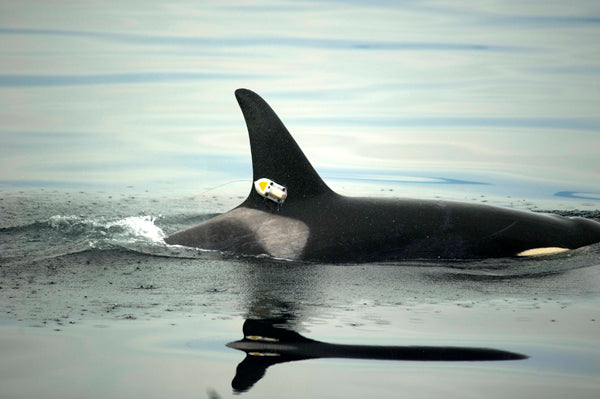
2. Acoustic Tags: Listening for Movement
While satellite tags are great for long-range tracking, acoustic tags offer a more detailed look at local behaviour.
How it works:
- The animal carries a small tag that pings a sound signal.
- Underwater listening stations (like hydrophones) detect these signals when the animal is nearby.
- Scientists can monitor movements in real-time and understand patterns in feeding, resting, or social behaviour.
This method is often used in
Coastal areas, where animals move within bays, reefs, or estuaries

This method is often used in
Marine protected areas, to evaluate if species are staying within safe zones

This method is often used in
Shark monitoring, especially for species known to come close to human-populated beaches

Fun Fact
In some regions, real-time shark tracking networks send automated text alerts to lifeguards when tagged sharks approach a beach.
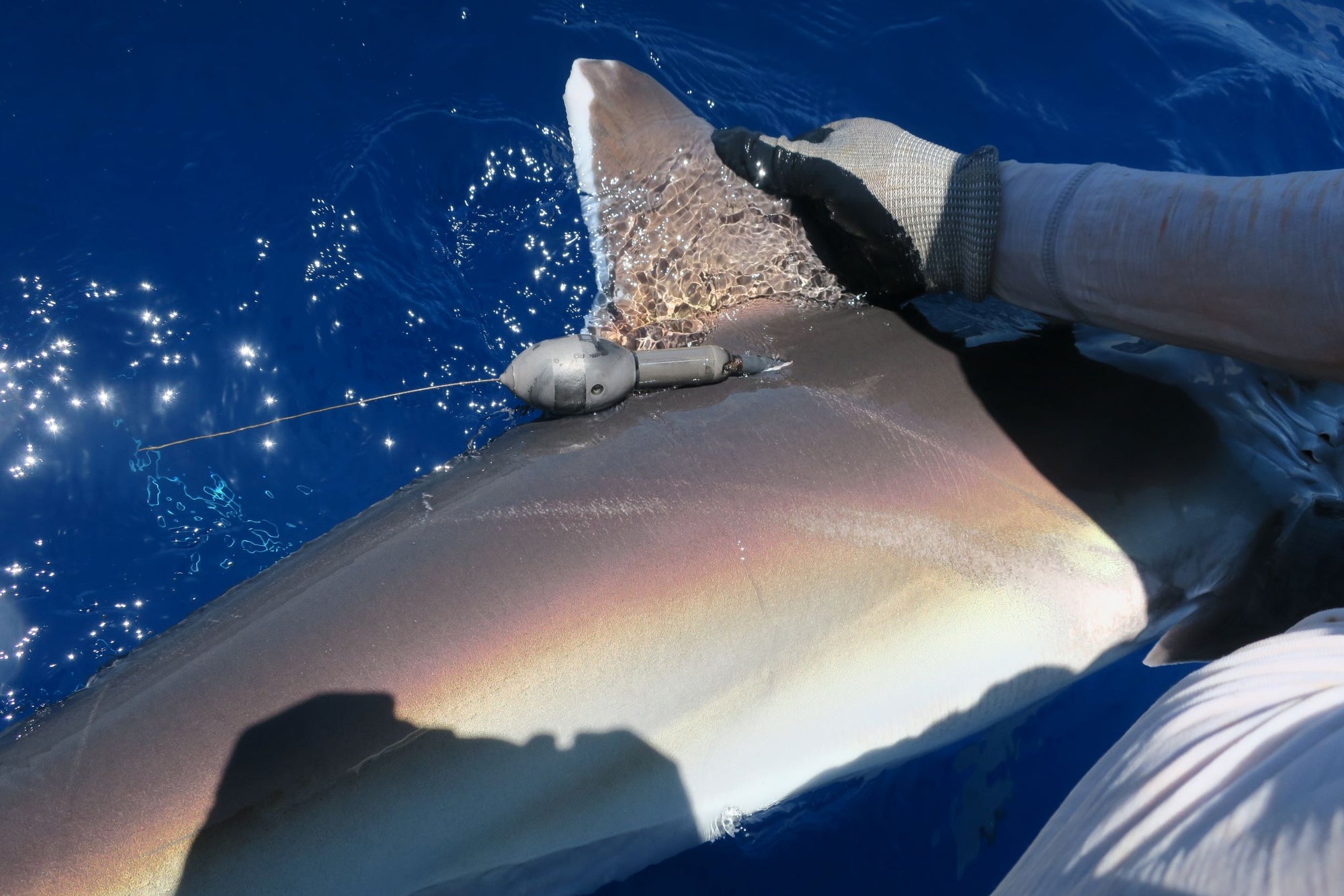
3. Archival and Pop-Up Tags: Diving Deep
Some animals dive too deep—or stay underwater too long—for satellite or acoustic tags to work well. That’s where archival tags come in.
- These devices record data such as depth, temperature, and light over time.
- After a set period, the tag detaches, floats to the surface, and transmits the data back to scientists.
What they reveal
Sperm whales diving to depths of over 1,000 metres to hunt squid

What they reveal
Great white sharks spending weeks in mysterious mid-ocean “cafés”

What they reveal
Leatherback turtles navigating deep water thermoclines in search of jellyfish

This data is vital for understanding how animals respond to temperature changes, prey availability, and human threats like fishing gear or shipping traffic.
4. Why This Matters: Science for Protection
Tracking marine animals isn’t just about curiosity—it’s essential for conservation.
Real-time tracking helps
Identify critical habitats like breeding grounds or migratory corridors
Guide the creation of marine protected areas (MPAs)
Inform policies that reduce threats from fishing, shipping, and pollution
Increase public awareness and support for marine conservation
For example, satellite tracking helped reveal that some shark species spend much of their lives outside national waters—leading to increased calls for international protection agreements.
Did you know?
Some tracking projects have public maps where anyone can follow a whale, shark, or turtle in real time.
Conclusion
Maps, Movement, and Marine Life
Thanks to tracking technology, the once-invisible journeys of ocean animals are now visible on our screens—and that’s changing everything.
By following the movements of whales, sharks, and turtles, scientists are unlocking critical knowledge about the ocean’s rhythms, health, and hidden connections. And with every data point, we’re better equipped to protect the creatures who travel its vast, blue highways.
Key Takeaways:
Satellite tags track long-distance movements of whales, sharks, and turtles via GPS signals.
Acoustic tags use underwater “listening posts” to study local behaviour in detail.
Archival and pop-up tags collect data on deep dives, temperature, and light over time.
Tracking helps scientists protect critical habitats and make informed conservation decisions.
NEXT LESSON
What Can Satellites Tell Us About the Ocean?
Beyond animal tracking, satellites reveal ocean temperature, algal blooms, coral reef bleaching, and more. Let’s look at Earth’s eyes from space.